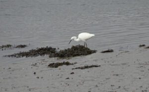
Plym Estuary at Saltram House
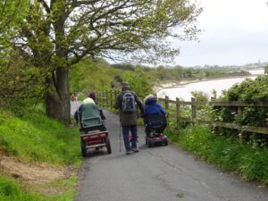
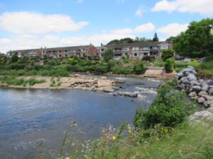
This is an easy Level One walk, in the grounds of the National Trusts Saltram House. Location : Plymouth Starting Point : National Trust Saltram
twentynineteen domain was triggered too early. This is usually an indicator for some code in the plugin or theme running too early. Translations should be loaded at the init action or later. Please see Debugging in WordPress for more information. (This message was added in version 6.7.0.) in /home1/wheelcl9/public_html/wp-includes/functions.php on line 6170
This is an easy Level One walk, in the grounds of the National Trusts Saltram House. Location : Plymouth Starting Point : National Trust Saltram
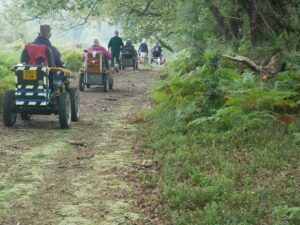
This ramble was the last of the eight accessible walks, of the Dartmoor Walking Festival 2021. Location : Bovey Tracey Starting Point : Car Park
This route was part of the 2021 Dartmoor Walking Festival. It is an easy Level 1 route with a very short ( 10 meters )
This is a Level One route which could be split into 2 shorter rambles, one of 3 miles and one of 4.8 miles. Location :
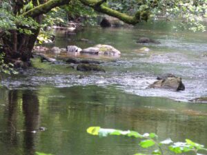
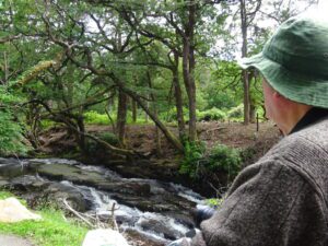
This is a nice walk alongside the River Teign south of Fingle Bridge. Location : Near Drewsteignton Starting Point : Fingle Bridge Inn OS Grid
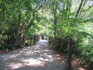
This route adds about half a mile, onto the Stover Lake Circuit by using part of the cycle route. Location : Stover County Park Starting
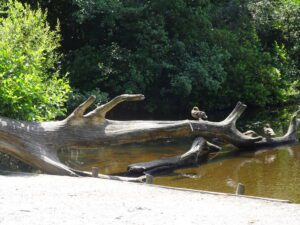
This is a short easy route around Stover Lake. Location : Stover Country Park Starting Point : Outside Rangers Office OS Grid Reference : SX832750
This is a Level One/Two due to a short steep path, from the cycle path to road. Also there is a slight incline in both
This is a short Level one there and back route suitable for all types of Scooter or power chair. Location : Sourton Starting Point :
This is an easy route with the best surface of all the walks in the Haldon Forest. Location : Haldon Forest Starting Point : Haldon

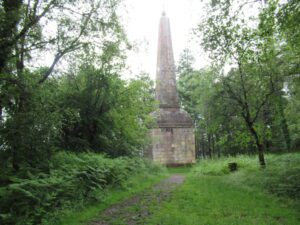
This is a short Forest track route suitable for most Mobility Scooters and Power Chairs. Location : Haldon Forest Starting Point : Obelisk car park
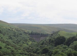
This ramble is an easy Level 1 up to the base of the Avon Dam Location : Near South Brent Starting Point : Shipley Bridge
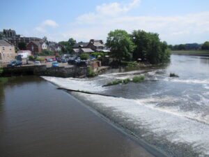
This is a nice easy Level One route, alongside the River Exe and the Flood relief channel. Starting at Exeter Quay, heading north towards Station
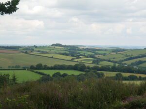
This ramble is at the top end of an easy route at 5 miles in distance. But one of our group reconnoitring the route for
This is an easy Category one ramble from Exeter Quay. Location : Exeter Starting Point Exeter Quay. but can be accessed from several points on
This is a easy Level 1 route of just over over 1 mile. Starting at the Exeter Quay, opposite the Custom House. Location : Exeter
This is a level 1 ramble suitable for most mobility scooters and power chairs. Location : Topsham Starting Point : Darts Farm OS Grid Reference
This is an easy level 1 ramble suitable for most types of Mobility Scooter or Power Chair. Location : Exmouth Starting Point : Long Stay

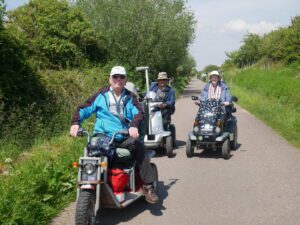
I am using a different mapping software and this is the first ramble using the new software. Click on the Learn more for details of
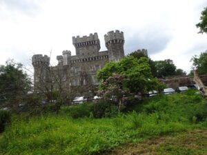
Location : Plymouth Starting Point : National Trust Saltram House OS Grid Reference : SX520555 Distance : 3 miles Route Surface : Asphalt, Fine gravel

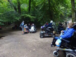
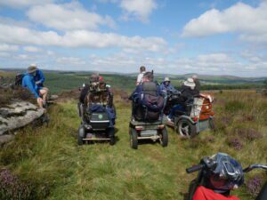
On Monday 4th October a small group of WAGs members, met at Princetown for a filming session on the Nunns Cross path. The Dartmoor National
This Route can be started from Sampford Peverell, or Tiverton Road car park near Halberton. Location : Sampford Peverell Starting Point : Village Car Park
Route 1 is a ramble along the eastern end of the canal from Sampford Peverell to Lowdwell Lock, This route is a Level 2 as
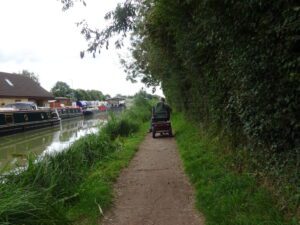
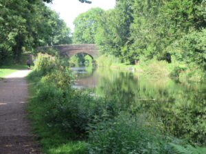
This ramble starts at Semington to the outskirts of Bradford upon Avon along the Kennet & Avon Canal. Location : Semington Starting point : Bridge
This route adds a quarter of a mile to the short route, but there is a section of about 3 to 4 yards that has
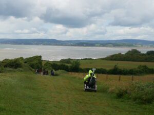
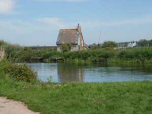
This ramble is from Exmouth Lifeboat Station to Sandy Bay via the Geoneedle marking the start of the Jurassic Coast. Location : Exmouth Starting Point
This route is a section of the Exe Estuary Trail from the Swans Nest to Starcross. Showing our friend from Cornwall some of our local
This is a Moderate Category 2 ramble due to overall distance and a short distance of fine gravel. Location : Exeter Starting Point : Exeter
This is a Moderate route on Asphalt with a distance of over 7 miles. Location : Exminster Starting Point : Exminster Marshes Car Park Ordnance
This is a short Level 3 route, which can be lengthened up to between 4 to 5 miles. This is also the starting point of
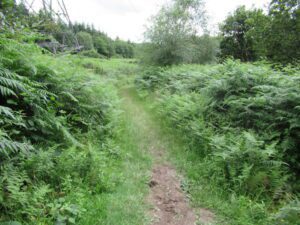
This is a level 3 ramble through two different types of woodland, with Yarner Woods being part of a National Nature Reserve. Location : Northwest
This is a short Level 3 ramble with the emphasis on the 5000 years of history, which is visible on the farm. Location : Between
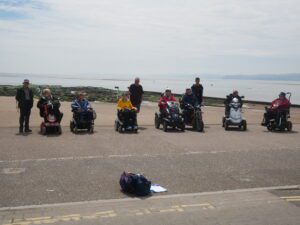
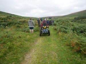
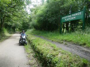
This was the most difficult of the Dartmoor Walking Festival Accessible Walks. Location : Belstone Starting Point : Car Park on the edge of the
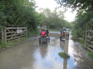
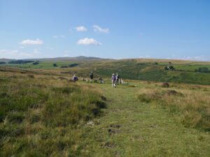
This is a route from the 2021 Dartmoor Walking Festival Accessible Walks. On the day the ground was dry enough to include a short spur
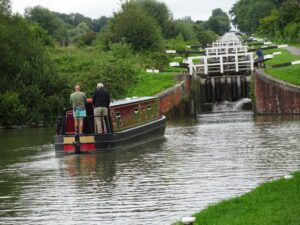
This is a lovely ramble from Semington to Caen Hill Locks near Devizes. Location : Semington Starting Point : Bridge north of Semington OS Grid
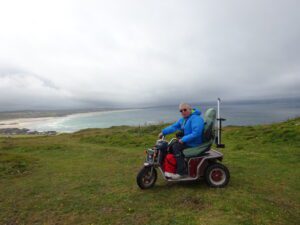
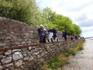
This is a short ramble giving lovely views of St Ives Bay to the west, while to the east you have views of North Cliffs.
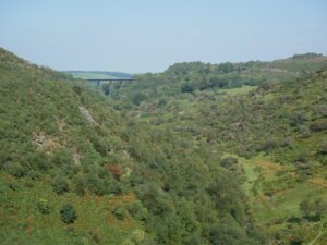
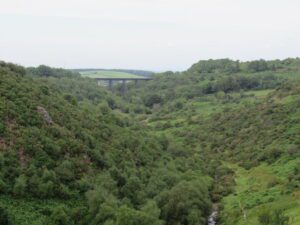
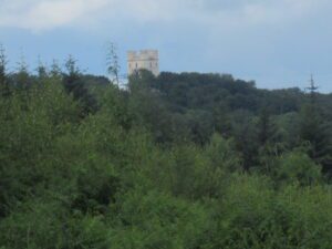
This is a level 3 due to the climb up to the Fort, then a steeper decent back down to the river valley. Location :
This route takes you out of the Country Park, so the path beyond the Park is a bit rougher. Location : Stover Starting Point :
Although it is a short ramble mainly on Asphalt, there is a short section of Permissive path. The permissive path is narrow and quite rough,

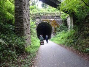
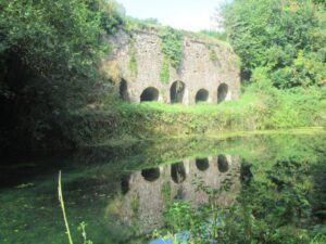
This is a ramble on the Camel Trail from Dunmere Halt up past the old China Clay drying sheds to the Snails Pace Cafe. Location
Another route on the Camel Trail, this time using the section that goes Bodmin to Padstow via Wadebridge. Location : Bodmin Starting Point : Camel
This is a short Level 3 and the most challenging of the 5 trails I have listed at the Forestry England Haldon location. Location :
Although this is a short ramble it is a Level 3 due to steep hills, so an All Terrain Scooter is required. Location : Haldon
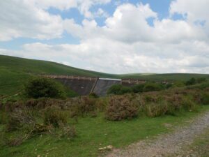
This Level Three route takes you to the top of the Dam, following a rough track for the last half mile. Location : Near South
This Ramble involved a short section on a busy A road, also crossing Lake Windermere on the ferry. Location : Windermere Starting Point : Park
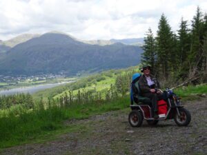
This was a wet weather option, to avoid the low cloud covering the hills. We followed a lane running the length of Coniston Water on
This is a Level 3 ramble due to distance and gradients. Location : Grizedale Forest Starting Point : Bogle Crag Car Park OS Grid Reference :

This is a difficult walk due to the distance and that most of it was on road. Location : Exeter and Haldon Forest Starting Point