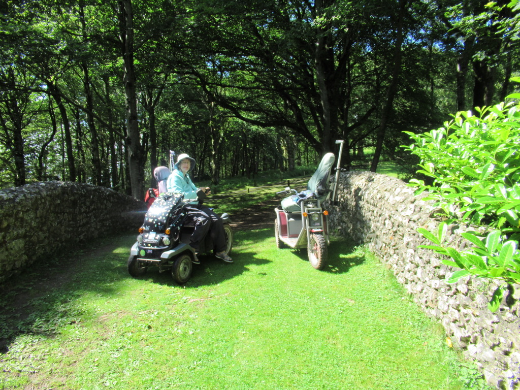
On Wednesday Gill and I went down to Bodmin, to meet fellow WAGs ( Wheeled Access Group ) member Norman on his home turf. Norman recently fitted Lithium batteries to his buggy, and wanted company to see how far he could go on the new batteries. We set of north from Dunmere towards Wensford Bridge, …
Author archives: Hopalong
Haldon Forest Discovery Trail

This is an easy route with the best surface of all the walks in the Haldon Forest. Location : Haldon Forest Starting Point : Haldon Forest Park OS Grid Reference : SX881849 Distance : 1.7 Miles Route Surface : Coarse Sand Category : Level 1 A mobility scooter is available for hire at this site …
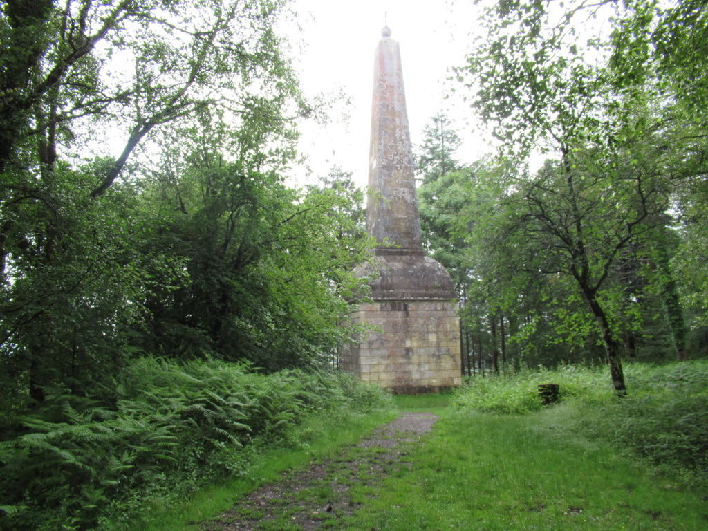
Mamhead Obelisk Long Loop
This route adds a quarter of a mile to the short route, but there is a section of about 3 to 4 yards that has exposed tree roots. This could be a problem with chairs/scooters with very small wheels. Location : Haldon Forest Starting Point : Obelisk car Park OS Grid Reference : SX921808 Distance …
Mamhead Obelisk Short Loop
This is a short Forest track route suitable for most Mobility Scooters and Power Chairs. Location : Haldon Forest Starting Point : Obelisk car park OS Grid Reference : SX921808 Distance : 1 mile Route Surface : Gravel for mot of the route or coarse sand Category : Level 1 No facilities This route is …
Haldon Forest Accessible Walks 12/7/21
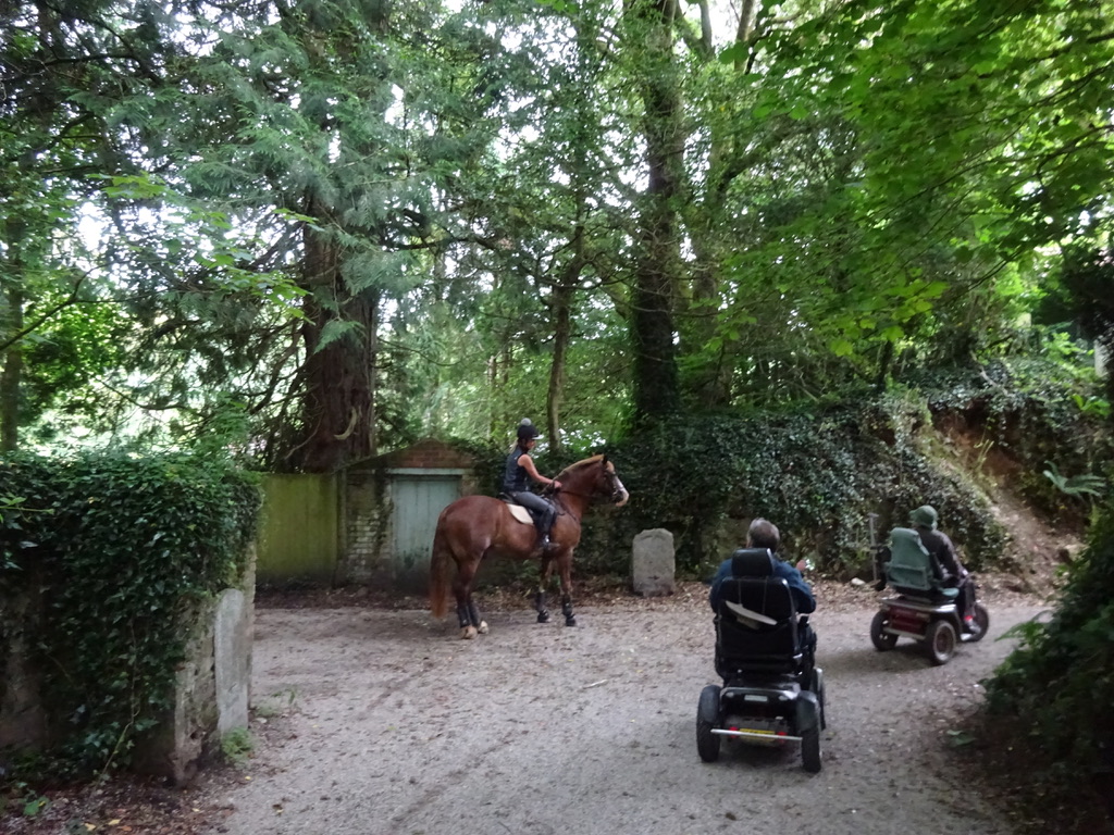
As there were changes to my plans for today, Monday, I decided to map out some short walks at Haldon Forest for my new Accessible Walks page. I have mapped 5 short walks, all under 3 miles in length, which will be added in the next day or so. There are several photos of the …
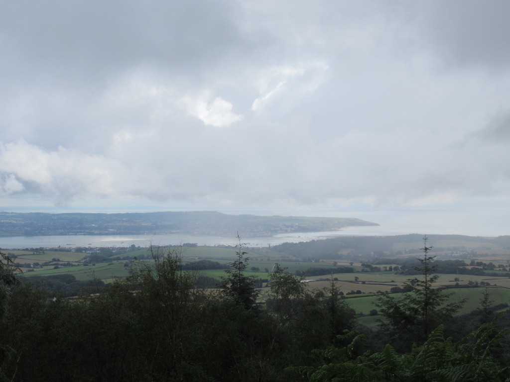
Saturday afternoon Road Trip 10/7/21
On Saturday as the weather improved in the afternoon, Gill and I decided to take a flask and do the trip up to Haldon Belvedere. What should have been a round trip of 12 or 13 miles, ended up being a 22 mile marathon. We stopped for a cuppa near the Belvedere, but could not …
Exmouth via Coast Path to Sandy Bay
This ramble is from Exmouth Lifeboat Station to Sandy Bay via the Geoneedle marking the start of the Jurassic Coast. Location : Exmouth Starting Point : Exmouth Lifeboat Station OS Grid Reference : ST012800 Distance : 3 Miles Route Surface : Part Asphalt, part crushed stone, part grass / bare compacted soil. Category : Level …
Southwest Coast Path / National Trust Reconnoitre 6/7/21
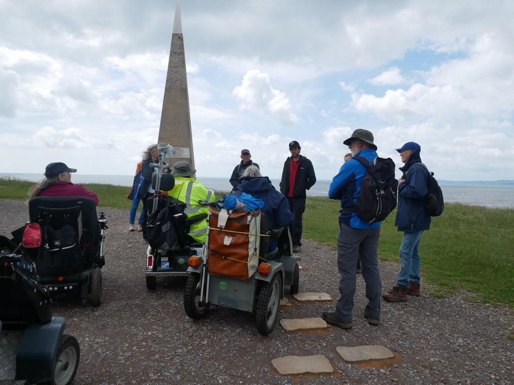
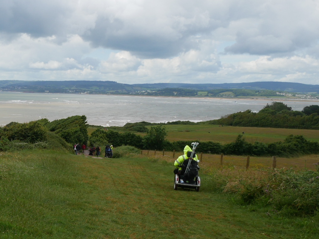
Today WAGs and Polio Group members, met at Exmouth Lifeboat Station, with representatives of the Southwest Coast Path Association, National Trust and East Devon District Council. The plan being to reconnoitre the short section of Coast Path, from the Lifeboat Station to the Geoneedle. This marks the start of the Jurassic Coast, in the Southeast …
Continue reading “Southwest Coast Path / National Trust Reconnoitre 6/7/21”
Avon Dam Level Three
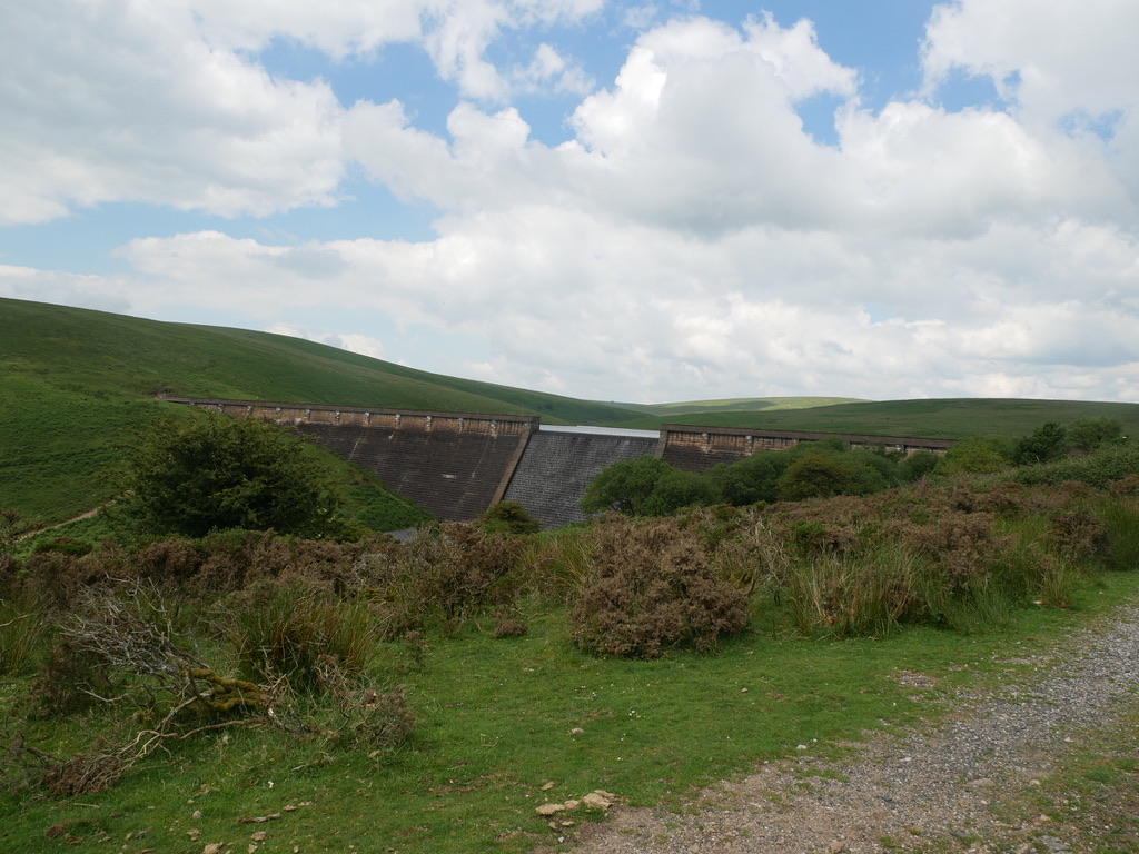
This Level Three route takes you to the top of the Dam, following a rough track for the last half mile. Location : Near South Brent Starting Point : Shipley Bridge car park OS Grid Reference : SX681629 Distance : 3.5 Miles Route Surface : Mostly Asphalt, with nearly half a mile of rough stoney …
Avon Dam Level One
This ramble is an easy Level 1 up to the base of the Avon Dam Location : Near South Brent Starting Point : Shipley Bridge car park OS Grid Reference : SX681629 Distance : 3.6 Miles Route Surface : Tarmac apart from the car park Category : Level 1 The biggest problem for people with …