Notice: Function _load_textdomain_just_in_time was called incorrectly. Translation loading for the twentynineteen domain was triggered too early. This is usually an indicator for some code in the plugin or theme running too early. Translations should be loaded at the init action or later. Please see Debugging in WordPress for more information. (This message was added in version 6.7.0.) in /home1/wheelcl9/public_html/wp-includes/functions.php on line 6131

Warning: Cannot modify header information - headers already sent by (output started at /home1/wheelcl9/public_html/wp-includes/functions.php:6131) in /home1/wheelcl9/public_html/wp-includes/feed-rss2.php on line 8
Solo trip – Wheelchairoffroad.org https://www.wheelchairoffroad.org Tue, 11 Oct 2022 16:46:34 +0000 en-GB hourly 1 https://wordpress.org/?v=6.9.4 https://www.wheelchairoffroad.org/wp-content/uploads/2021/07/cropped-25332-32x32.png Solo trip – Wheelchairoffroad.org https://www.wheelchairoffroad.org 32 32 Battery Test https://www.wheelchairoffroad.org/battery-test/?utm_source=rss&utm_medium=rss&utm_campaign=battery-test Tue, 11 Oct 2022 16:46:34 +0000 http://www.wheelchairoffroad.org/?p=3684 Continue reading "Battery Test"

]]>
This was a solo trip to see how far I could go with the new Lithium batteries in the 4 wheeled Tramper. My 3 Wheeler has gone to a good home in North Devon.

Exe Estuary Trail

Map / Exe Estuary Trail
Difficulty
Distance 64.6 km
Duration 7.6 h
Ascent 398 m
Descent 375 m
I started from home going along the canal, joining the Exe Estuary Trail, to Exmouth. Then following the National Cycle Route 2 towards Budleigh Salterton, until the traffic free section finished. I then climbed up to the Southern edge of Woodbury Common, using an old farm track. Then down another farm track to the village of East Budleigh, were I followed a lane and a short section of main road back to the traffic free cycle path.
Having got back to Exeter Quay, I still had just over 10 AH (Amp hours ), so did a short loop of about 3 miles. This up Redhills as far as Barley Lane, and back down Dunsford Hill, making it a distance of 39.8 miles
]]>
Grand Western Canal 6/9/21 https://www.wheelchairoffroad.org/grand-western-canal-6-9-21/?utm_source=rss&utm_medium=rss&utm_campaign=grand-western-canal-6-9-21 Thu, 09 Sep 2021 09:40:20 +0000 http://www.wheelchairoffroad.org/?p=2862 Continue reading "Grand Western Canal 6/9/21"

]]>
Today Gill was with a friend, so I did a solo trip, on the canal to map out 2 more walks for the Accessible Walks page. I parked up in Sampford Peverell and headed east to Waytown Tunnel and Lowdwell Lock. Then after Lunch I headed west pass Halberton finishing at the Tiverton Road car park.

The Canal near Sampford Peverell
The Canal near Burlescombe
A family of 10 Cygnets near Burlescombe preening in the sunshine on my way to Lowdwell Lock

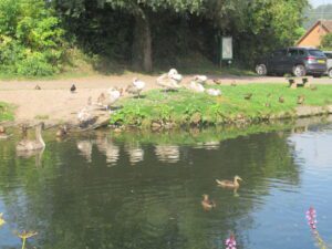
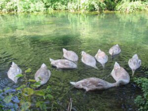
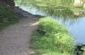
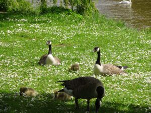
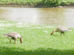
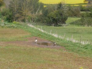
It is unusual to see such a large family of swans, in both photos the parents are nearby.

The 10 Cygnets feeding on my return trip
The Waytown Tunnel entrance partly obscured by the undergrowth

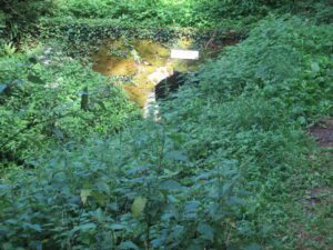
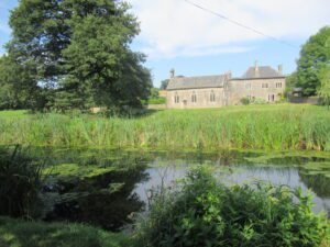
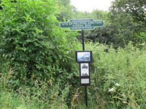
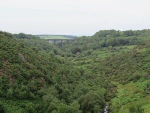
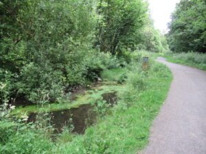
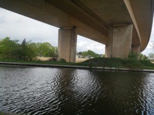
In the winter when the vegetation has died back, you get a much better view of the tunnel. The Waytown Lime Kilns in the feature photo, were one of the reasons for building the canal. There was a plan to link the English Channel, with the Bristol Channel. The arrival of the railways, knocked that plan on its head.


The end of the canal at Lowdwell Lock
The channel where the canal used to continue down to the River Tone through a series of locks
One of several information boards along the canal
A Moorhen busy feeding as I approach one of the many bridges on the canal
A Chapel in the garden of a farmhouse alongside the canal
Fellow WAGs member on one of the safety posters either side of the bridges
One of the bridges near Halberton
A Kingfisher trying to hide below some over hanging branches

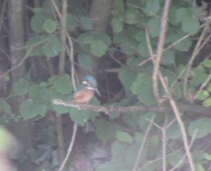
The distance from where this Kingfisher was perched, resulted in the poor quality photo, but worth including. It’s very rare to actually get a siting of a Kingfisher and today I saw Mr and Mrs.


]]>
Granite Way Solo Trip 23/7/21 https://www.wheelchairoffroad.org/granite-way-solo-trip-23-7-21/?utm_source=rss&utm_medium=rss&utm_campaign=granite-way-solo-trip-23-7-21 Sat, 24 Jul 2021 11:07:20 +0000 http://www.wheelchairoffroad.org/?p=2485 Continue reading "Granite Way Solo Trip 23/7/21"

]]>
This afternoon (Friday) I went to the Granite Way, to map a further 3 routes for my Accessible Walks. All three start from the Pump and Pedal cafe & cycle shop, one to Meldon Viaduct, one to Meldon Dam and one to the Lake Viaduct.

Information about the Meldon Signal Box
Approach to Meldon Viaduct

As it is a route we have done several times, I have not taken many photos today. It was really warm when I started, just after 2pm. But by 5pm there was quite a breeze, with me wishing I had a fleece with me.

Meldon Dam viewed from the Viaduct
Meldon Viaduct viewed from Meldon Dam
Meldon Reservoir
Meldon Dam is Accessible for all types of Mobility Scooter or Wheelchair

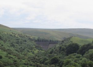
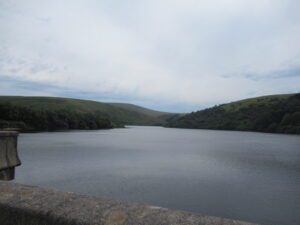
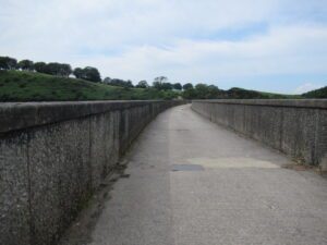
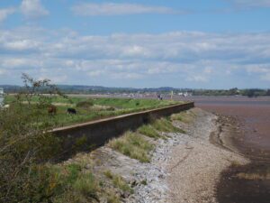
The access to the dam is good, but at the far end there is a gate onto a rougher track. There is plenty of room to turn around on the dam itself, as you definitely need a robust scooter to try the path alongside the reservoir.

Plenty of parking on the road approaching the Pump and Pedal

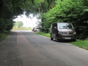
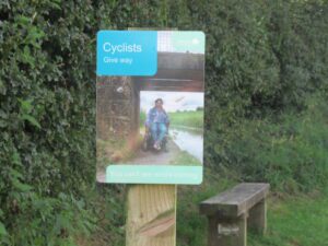
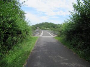
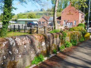
There is limited parking outside the Pump & Pedal, so I have included this photo to show there is parking on the road.

One of several named ponds alongside the cycle path
View looking east from Lake Viaduct
View looking west from Lake Viaduct

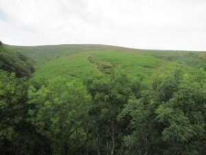
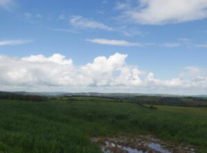
The views from the Lake Viaduct, among my favourite on the western edge Dartmoor. In the next few months, I will be be mapping the routes from Okehampton Station to Meldon.


]]>
Haldon Forest Accessible Walks 12/7/21 https://www.wheelchairoffroad.org/haldon-forest-accessible-walks-12-7-21/?utm_source=rss&utm_medium=rss&utm_campaign=haldon-forest-accessible-walks-12-7-21 Mon, 12 Jul 2021 19:50:54 +0000 http://www.wheelchairoffroad.org/?p=2259 Continue reading "Haldon Forest Accessible Walks 12/7/21"

]]>
As there were changes to my plans for today, Monday, I decided to map out some short walks at Haldon Forest for my new Accessible Walks page. I have mapped 5 short walks, all under 3 miles in length, which will be added in the next day or so.

One of the good quality tracks on the Obelisk walk
The view of Exmouth from the View point above Mamhead House
The narrower track on the Obelisk long loop

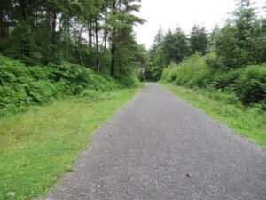
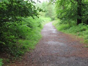
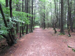
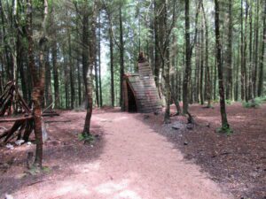
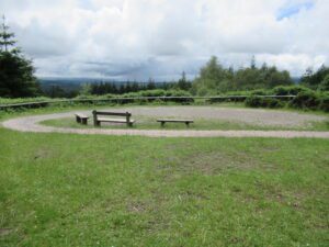
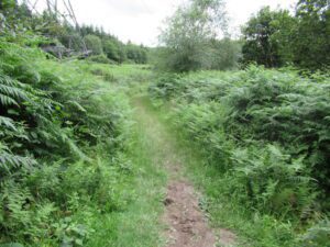
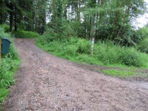
There are several photos of the tracks today as the purpose of the day was to measure the distance and grade the walks on the surface quality and gradients.

This a good quality coarse sand covered track
One of the structures aimed at entertaining young children
The Raptor Viewing area with lovely views of the Teign Valley and Dartmoor
View of Exeter and the Mid Devon countryside
Haldon Belvedere
A rather narrow section of path on the Butterfly Walk
This shows the colour coded signs for the different walks
View looking west from the Discovery Walk

Gill had a girly day with friends, so this was a solo trip. But I managed to do five short walks, which I will be adding to the new Accessible walks page, over the next couple of days.


]]>
Solo Trip 17/5/21 & Afternoon with Gill 19/5/21 https://www.wheelchairoffroad.org/solo-trip-17-5-21-afternoon-with-gill/?utm_source=rss&utm_medium=rss&utm_campaign=solo-trip-17-5-21-afternoon-with-gill Thu, 20 May 2021 14:56:48 +0000 http://www.wheelchairoffroad.org/?p=1713 Continue reading "Solo Trip 17/5/21 & Afternoon with Gill 19/5/21"

]]>
Today despite the threat of showers, I decided to explore some Devon lanes. I set off with a packed lunch in dry conditions, stopping at Motortone for some gentle exercise on the way. It started raining while I was in Motortone, but as it was light rain and I had my waterproofs, I decided to carry on with my plan. I headed for the Twisted Oak then crossing the A30, on the footbridge into Ide. Due to the rain I did not take many photos today.

Looking across the fields towards Exeter

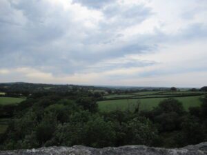
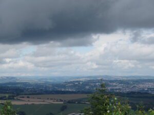
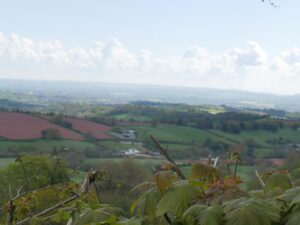
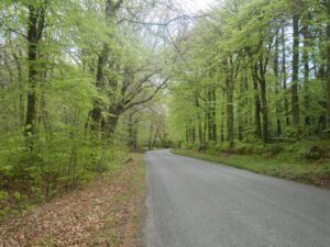
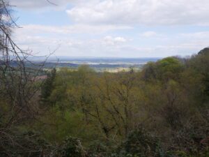
From Ide I headed for Dunchideock, taking a turning to Clapham, on the outskirts of the village. This lane is narrow and very muddy in places, after all the recent rain. From Clapham I headed for Kennford, passing the farm renown for it’s orange elephant. Immediately after crossing the A38, I joined the Old Dawlish Road heading for Exminster. By this time the rain had stopped, so I stopped for lunch in a gateway affording me lovely views of Exeter, and the surrounding countryside. The beauty of this time of year, is all the bird activity with it being nesting season. With traveling at five mph or less on the mobility scooter, you see so much with the Devon hedges. But it is what I hear as well as seeing, which compounds my enjoyment.

One of the smaller puddles I had to cope with today.

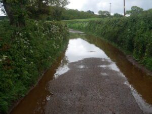
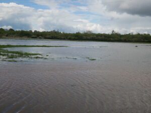
It was not long after finishing my lunch, that it started raining again. On my way into Exminster I decided to go pass the Swans Nest, to join the Exe Estuary Trail along side the canal, back to home. The lane was flooded about 300 yards from the Trail, so I crept into floodwater keeping in the middle of the lane. It soon became apparent the water was too deep for the buggy, so I reversed out of the flood water. As it was still early afternoon, I decided to add 5 miles to the journey, by joining the cycle trail at Powderham.

View of Exeter from my lunch stop south east of Lears Wood on the Old Dawlish Road
View of the Exe Estuary from my lunch stop spot.

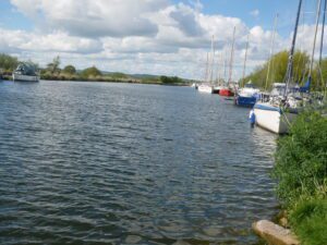
So headed back into Exminster, then taking the lane pass Exminster Golf Club. There were a couple of large puddles in the lane, before crossing the A379 about halfway between Exminster and Kenton. There was another large puddle on the outskirts Powderham, but had a couple of inches clearance so able to continue. By the time I got to Turf Hotel the rain had stopped, so had a coffee stop near the Motorway in the sunshine.

Retreat Hose in Topsham from the canal path below the Motorway bridge
Looking towards Newport Caravan park from under the M5 motorway
A few weeks ago the farmer had put his cattle in this field

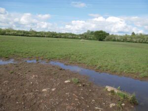
Wednesday was a lovely day so we both headed down to Powderham, with a flask to enjoy the afternoon sunshine. On the way back I took the picture below, with the flood water gone.

Same Field 48 hours later
Some of the boats moored at the Turf Hotel
Canadian Geese with young near Exeter Quay
A pair of Egyptian geese have turned up a couple of weeks ago at Exeter Quay

After the damp day out on Monday, the sunshine on Wednesday was lovely, Also with the sunshine there was a lot more birdsong to enjoy.

]]>
Haldon and Starcross 7/5/21 https://www.wheelchairoffroad.org/haldon-and-starcross-7-5-21/?utm_source=rss&utm_medium=rss&utm_campaign=haldon-and-starcross-7-5-21 Sat, 08 May 2021 12:38:20 +0000 http://www.wheelchairoffroad.org/?p=1645 Continue reading "Haldon and Starcross 7/5/21"

]]>
Today Gill was having a girly day out with a friend, so I did a solo trip, on my buggy. Two thirds of the trip was on relatively quiet roads. The last 10 miles was on the Exe Estuary Trail, from Cockwood to home.

Passing the Twisted Oak pub on my way to the village of Ide
View of Lawrence Castle ( Haldon Belvedere ) from the lane between Ide and Dunchideock

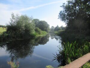
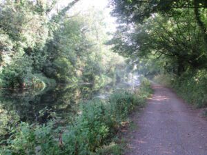
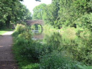
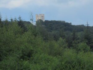
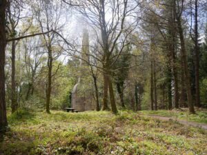
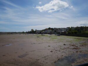
From  home I headed to the Twisted Oak pub crossing the A30 into the village of Ide. Then I climb up through the village of Dunchideock to Lawrence Castle.  I then went off road for a short distance, on my way to the Ashcombe Obelisk. I used Jackdaw Hill for my decent off the Haldon Hills,  heading for Cockwood, where I joined the Exe Estuary Trail for the journey home.

View over the hedge towards Exeter from the lane between Dunchideock and Lawrence Castle
Large Rhododendron in full flower in the grounds of Lawrence Castle.
View of Exmouth from the viewpoint at the Ashcombe Obelisk on Little Haldon
Ashcombe Obelisk hidden by trees

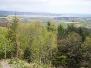
From the Obelisk I headed towards Cockwood, from where I followed the Exe Estuary Trail back into Exeter. I stopped for lunch on the edge of Black Forrest, not far from Kenton. The area has a lot of pleasant memories, as I lived in Kenton from the age of nine, until I left home at the age of eighteen.

Avenue of Beech Trees coming into leaf on the approach to Jackdaw Hill
View of Exe valley from the top of Jackdaw Hill
One of several fields of Oil Seed Rape in full flower between Black Forest and Warboro Woods west of Starcross

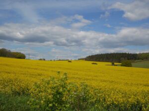
With fields of Oil Seed Rape on both sides of the lane, the fragrance was really strong.

A pair of Canada Geese investigating a field puddle west of Starcross
Cockwood Harbour at low tide
Deer in the grounds of Powderham Castle
Looking up river towards Topsham from Powderham next to the Exe Estuary Trail bridge over the railway lines
View of Topsham from the Exeter Canal side at the Ferry crossing

Although it was a mainly sunny day, there was still a cold wind, so I was glad it was a tail wind for the Exe Estuary Trail section of the journey. The joy of traveling at 5 to 6 mph, I get to to enjoy the diversity of Flora in the hedgerows. Also being able to hear the birdsong, in the hedges and trees, at least twice I heard young chirping from their nests. The route can be viewed on the link below, my new GPS gives altitude readings as well as distance and speed. The lowest was 1ft, while the highest was 849ft, so quite a drain on the buggies batteries.

Haldon & Starcross

]]>