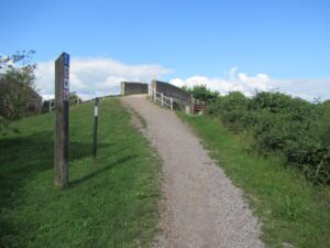
Starting Point : National Trust Saltram House
OS Grid Reference : SX520555
Distance : 3 miles
Route Surface : Asphalt, Fine gravel / sand, Compacted stone / earth
Category : Level 2
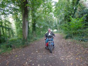
A mobility scooter is available for hire at this site through the Countryside Mobility Scheme.
This route is only 3 miles but the section through the Dell, is compacted stone and earth. Therefore not suitable for small wheeled scooters, and some Powerchairs.
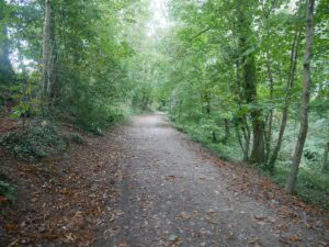
This track has a narrow strip of trees, on either side for most of its length, so plenty of birds in the trees. Most of the time it is a case of hearing them, rather than seeing them.
This is still a good surface after rain, if there are any puddles, it is easy to avoid them. The route can be shortened, by cutting out the section alongside the Plym Estuary. For more detailed information, speak to the National Trust staff or volunteers.
]]>
Location : Sampford Peverell
Starting Point : Village car park
OS Grid Reference : ST032144
Distance : 9.6 Miles
Route Surface : Gravel
Category : Level 2 / 3
This route can be shortened at any point, dependant on your personal / Scooter abilities. I have graded it a Level 2 as far as Waytown Tunnel, purely on distance. The level 3 tag for the final part, is a combination of steep path and opening a gate.
There is plenty of wildlife to look out for, on this section of the canal. The feature photo is the Waytown Lime Kilns.
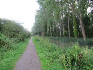
]]>Location : Semington
Starting point : Bridge north of the village
OS Grid Reference : ST900612
Distance : 9.1 miles
Route Surface : Mainly gravel, with a few stoney sections
Category : Level 2
On paper this looks like a nice easy route, on a towpath that is also a national cycle route. The towpath is very narrow in places, making it difficult to pass other users. The grass between the gravel and the hedge, is at such a slope it is difficult to pass cyclists with our Trampers.
I have graded it a Level 2 partly on distance, but also on the quality of the path in places.
Location : Haldon Forest
Starting Point : Obelisk car Park
OS Grid Reference : SX921808
Distance : 1.25 Miles
Route Surface : Gravel
Category : Level 2
No facilities
This again is an easy short circuit, apart from a few exposed tree roots, which would be difficult for scooters with the very small wheels ( less than 4 inches in diameter ).
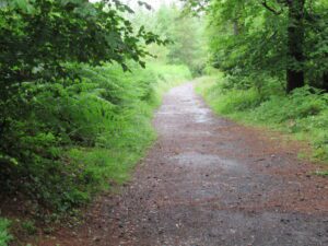
As with the short loop walk, the viewpoint is the main feature of this walk. Although it is a very short walk, I have rated it as level 2 due to the tree roots

]]>
Location : Exmouth
Starting Point : Exmouth Lifeboat Station
OS Grid Reference : ST012800
Distance : 3 Miles
Route Surface : Part Asphalt, part crushed stone, part grass / bare compacted soil.
Category : Level 2
Disabled Toilet in the car park opposite the Lifeboat Station
The original plan was to do from the Exmouth Lifeboat Station to the to the Geoneedle marking the western end of the Jurassic Coast. This section of the route is easy Level One, we split into two groups for the first part. Group 1 went up the narrow footpath off Foxholes Road, which starts just up from the car park. Group 2 went up Foxholes Road on the pavement, which is a steady climb, but no problem for the smaller scooters.
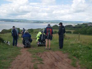
The last section to the Geoneedle is on gravel/crushed stone, and again the smaller scooters were fine. We were unable to reach the Sandy Bay Holiday Park, as the last 100 yards are too steep and stepped. In good dry conditions the route to the point at the top of the slope, above the Holiday Park is a Level 2. In wet conditions it is a Level 3, as the bare soil can be Slippery.

We did this route, with representatives of the Southwest Coast Path Assoc. National Trust and East Devon District Council. It gave them an opportunity to see first hand the capabilities of the different types of Scooters / Wheelchairs.
]]>Location : Exeter
Starting Point : Exeter Quay
OS Grid Reference : SX920921
Distance : 5.5 Miles
Route Surface : Asphalt with a short section of fine gravel.
Category : Level 2
This is an easy moderate walk at just over the 5 miles, with about 0.5 miles of fine gravel. There are several paths to choose from, on the route between the Quay and the Swing Bridge on Bridge Road.

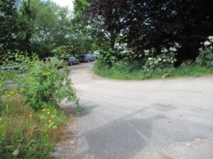
It is also possible to park at the end of Salmon Pool Lane (OS Ref. SX931909) for this ramble. There is a third option to park, just off Bridge Road, the entrance is between the two bridges. See photo below. (OS Ref. SX900894) This is also one of the access points, to the Riverside Country Park. But due to the kissing gates at either end, we are unable to access the park. I have been advised that Access is going to be improved in the current financial year.
With so many options of different paths available, you can increase the amount of gravel track, or avoid it completely. Which ever paths you choose, it will not affect the overall distance of the ramble by any significance distance.
]]>
Location : Exminster
Starting Point : Exminster Marshes Car Park
Ordnance Survey Reference : SX954873
Distance : 7.5 miles
Route Surface : Asphalt with Speed Bumps ( which can be avoided )
Category : Level 2
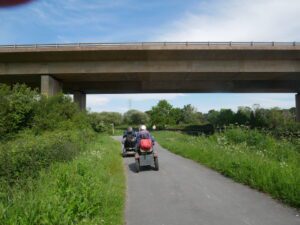
Description : You can park in the Swans Nest car park (with permission ) or the Exminster Marshes car park. Head east towards the Exe Estuary Trail alongside Exeter Canal going pass the Lions Rest Business Park. Turn left towards Exeter on the cycle path, after passing under the Motorway the canal widens.
At this point there is the option to go along a lane to the A379 near the Matford Business Park. Follow the cycle path towards Exeter, crossing Bridge Road by Matford Roundabout. Turn left here to follow cycle path onto Marsh Barton, the RSPB Reserve is on your right with two viewing points. Then retrace your route back to Bridge Road crossing over by the canal swing bridge, to follow the canal south and back to your starting point.
]]>