Location : Meeth
Starting Point : Devon Wildlife Trust car park
OS Grid Reference : SS540085
Distance : 2.3 Miles
Route Surface : Mixture of rough stoney track with gravel easy areas, with shallow puddles.
Category : Level 3
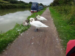
The Devon Wildlife Trust site is based on what was an old Quarry, which consists of 3 small lakes. There are a network of tracks on the site, which I hope to explore in more detail in the future.
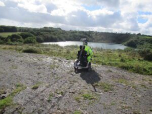
While most of the tracks are of reasonable surface, there are sections that need an ALL Terrain Mobility Scooter. Apart from the rough sections, there are lots of puddles, some of which can not be avoided.
I will update this walk with more detail, at a later date but wanted to make people aware of the site.
]]>
Location : Sampford Peverell
Starting Point : Village car park
OS Grid Reference : ST032144
Distance : 9.6 Miles
Route Surface : Gravel
Category : Level 2 / 3
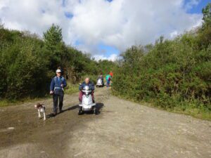
This route can be shortened at any point, dependant on your personal / Scooter abilities. I have graded it a Level 2 as far as Waytown Tunnel, purely on distance. The level 3 tag for the final part, is a combination of steep path and opening a gate.
There is plenty of wildlife to look out for, on this section of the canal. The feature photo is the Waytown Lime Kilns.
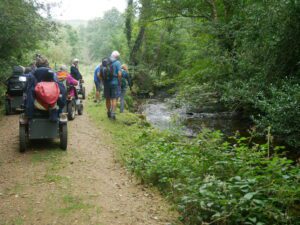
]]>Location : Northwest of Bovey Tracey
Starting Point : Pullabrook car park near Drakeford Bridge
OS Grid Reference : SX789801
Distance : 3.4 Miles
Route Surface : Stoney Woodland Track
Category : Level 3
This ramble does include a short distance on a road, but not usually very busy. From the car park follow the Track into the woods, there is the option to go to a small meadow alongside the River Bovey. After which go back to main track to start the climb out of the valley, the final part on the Byway up to the road is very steep.
There are several options of a circular route, with in Yarner Woods so the choice is yours. I will give more detail of the options, in the near future.
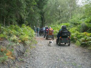
After the circular route within Yarner Woods, you retrace your route, via the Byway and Pullabrook Woods.
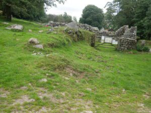
]]>Location : Between Postbridge and Widecombe in the Moor
Starting Point : Challacombe Farm
OS Grid Reference : SX695796
Distance : 4.5 miles
Route Surface : Grass, Stoney Sections of Track
Category : Level 3
From the farmhouse the route follows the footpath north towards Headland Warren Farm. When you reach the stone wall, turn around and head back to the farmhouse. There are examples of mining and terrace farming, some of it going back 1000’s of years.
From the farm we head over Challacombe Down, towards Golden Dagger Mine then on into Soussons Woods.
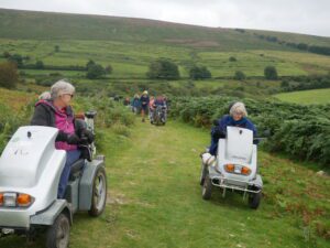
Soussons Woods was part of the conifer planting project after the two World Wars. Most of this route is on grass, with a couple of sections of stoney track which is a bit rough.
]]>Location : Belstone
Starting Point : Car Park on the edge of the village
OS Grid Reference : SX622938
Distance : 4.75 Miles
Route Surface : Asphalt, Grass, Stone Track (very rough in places)
Category : Level 3 Plus
The route starts as Asphalt through the village, once through the gate onto the open moor, you go on the grass up to the flagpole at the top of Watchet Hill. Then on to Nine Maidens, where you go back towards Belstone, to find suitable access to the track for Cullever Steps.
The Track down to Cullever Steps is rough in places, but the roughest section is the track up past Winter Tor.
The route from near Winter Tor to the Taw Valley is a grass path, which is steep in places. Therefore needs to be treated with respect, especially if the grass is wet. Once in the Taw Valley the track is rough for last couple of hundred yards, before leaving the open moor. The last section is asphalt, back to the village.
]]>
.
Location : Bellever Dartmoor
Starting Point : Forestry England car park.
OS Grid Reference : SX655771
Distance : 5.3 Miles
Route Surface : Good surface on Forest Track, rough stone track on the open Moor
Category : Level 3
There are Toilet facilities in the car park, but Postbridge is the nearest point for refreshments.
This is definitely a route for All Terrain Scooters, as the track on the open moor to Dunnabridge Pound is rough. The path up to Laughter Tor, is mainly grass and is fine in dry conditions. But should be avoided in wet conditions.
We went down to the river to look at the Clapper Bridge, before heading through the forest towards Dunnabridge. We pass a derelict farm house, before making our way onto the open moor. Once on the open moor the track is very rough, but not overly difficult.
There are a couple of short sections, where the camber has to be treated with respect, particularly with 3 wheeled models of scooter.
]]>
Location : Semington
Starting Point : Bridge north of Semington
OS Grid Reverence : ST900612
Distance : 12.4 miles
Route Surface : Gravel with pot holes
Category : Level 3
This route is on the towpath of the Kennet & Avon canal, which is also part of the National Cycle Route network.
The 2 mile length of path past the Caen Hill Locks is a Level 1, but the route from Semington to the top of Caen Hill, is a Level 3 as it over 10 miles.
There is a road crossing which needs great care, especially traveling in a westerly direction. Apart from this road crossing, the rest of the route is nice and relaxing.
]]>
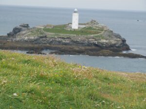
Location : Gwithian
Starting Point : National Trust Field Car Park Godrevy
OS Grid Reference : SW581431
Distance : 1.9 Miles
Route Surface : Fine Gravel / Sand. Grass / Dirt / Stones.
Category : Level 3
The National Trust have 3 car parks on the site, the first 2 are asphalt, while the 3rd is grass. The distance given for this ramble is from the field car park, so add about 0.5 miles from the main car park. The path up to the seal viewing point has been improved, so is a Level 1 route suitable for most types of scooter and wheelchairs.
The section on Godrevy Point and the path to the Knavocks, is a Level 2 it is only the final part of the route is Level 3. After passing through a gate the path is rutted, while the section up to the Trig Point, has quite a camber. This section is a good grass surface, but an uncomfortable camber for some people.
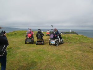
If you are parked in either of the first 2 car parks, it is a asphalt road up to the point where the improved path starts.
]]>Location : Near Drewsteignton
Starting Point : Fingle Bridge Inn
OS Grid Reference : SX742899
Distance : 4.4 Miles
Route Surface : Gravel / Small Stone
Category : Level 3
This walk involves a climb of over 350ft. therefore only suitable for more robust mobility scooters. The views from both the Fort and the track, are worth the effort. The Woodland Trust have marked this route with Orange way markers, so is easy to follow.
The steepest part of the decent needs to be treated with respect, otherwise it’s a lovely route.
]]>