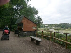
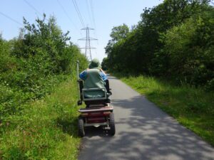
Location : Plymouth
Starting Point : National Trust Saltram House
OS Grid Reference : SX520555
Distance : 2 Miles
Route Surface : Asphalt and Fine gravel / sand
Category : Level 1
A mobility scooter is available for hire at this site through the Countryside Mobility Scheme.
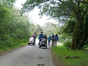
This is an easy Level 1 route suitable for most small scooters and Powerchairs. If you do the route clockwise on a small scooter, there is a short climb back to the car park. If you do it anti-clockwise, the climb is more gradual.
The gravel path alongside the Plym Estuary, is part of the National network of cycle paths. This means it is usually maintained to a good standard.

While my wife and I both have All terrain Trampers, but we have accompanied other users of small scooters on paths rougher than this.
]]>
Location : Bovey Tracey
Starting Point : Car Park by the river
OS Grid Reference : SX781813
Distance : 3.3 Miles
Route Surface : Asphalt, Gravel.
Category : Level 1
This walk is a level walk apart from a steep slope down to the river, which was just an add on for our lunch stop.
The path through the park is Asphalt, while the rest of the route through the Parke NT estate is gravel. The path that takes you off the Railway Line, to the NT cafe has a short stoney section. This section upgrades the walk to a level 3, so users of power chairs and small scooters need to stay on the main path.
I had a problem with the GPS which I didn’t spot, until we were on the old railway line. The distance of 3.3 miles is correct distance for the whole route.
]]>
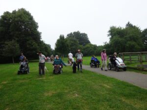
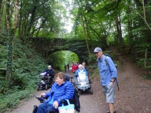
Location : Clearbrook
Starting Point : Car Park on the right before the village
OS Grid Reference : SX518651
Distance : 7.8 miles
Route Surface : Mainly Asphalt, with a fine gravel section
Category : Level 1
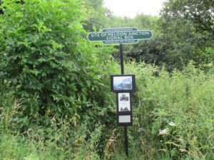
From the car park head down the hill into Clearbrook, to join the cycle path towards Plymbridge Woods. Go through Leighbeer Tunnel, lookout for the old mine workings on the left in the tunnel. Turn around and head back towards the car park, turning right onto the Tramway towards Yelverton.
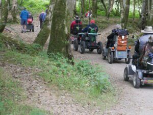
On the outskirts of Yelverton, Drakes Leat is on one side of the path. While the Devonport Leat is on the other side of the path.
As this route was part of the Dartmoor Walking Festival, we had a guide giving us a lot of historical information. RAF Station Harrowbeer at Yelverton, was our final destination of the day. For users with restricted range, you could treat this as 2 separate rambles.
]]>Location : Near Drewsteignton
Starting Point : Fingle Bridge Inn
OS Grid Reference : SX742899
Distance : 5 Miles
Route Surface : Coarse Gravel / Small Stone
Category : Level 1
There are a couple of slight inclines, otherwise a reasonably level route following the River Teign. With the small stone surface there is nothing to stop the very small scooters, but will make it a bumpy ride in places.
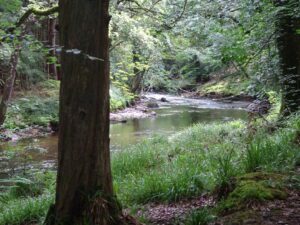
If you are lucky you might spot a Dipper, or a Grey Wagtail on the rocks in the river.
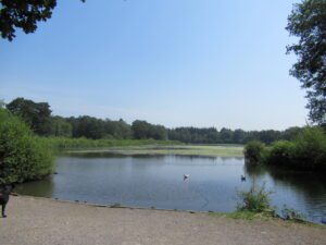
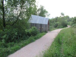
]]>Location : Stover County Park
Starting Point : Outside the Rangers Office
OS Grid Reference : SX832750
Distance : 1.3 miles
Route Surface : Fine Gravel and Asphalt, with a short section of slightly rougher track
Category : Level One
A mobility scooter is available for hire at this site through the Countryside Mobility Scheme.
There is a disabled toilet, but access with larger mobility scooters is difficult, if not impossible.
Over half of this route is alongside Stover Lake, if travelling in a Clock wise direction take a left after the first bridge. This is the Asphalt section, which follows the line of pylons. Turn Right where a stone track crosses the cycle path, which takes you back to the Lake.
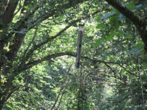
The Arial Walkway is always popular with visitors, but it does not stop the birds from feeding.
As this section is managed for the pylons, it is popular for butterflies. Even though the short stone track is a bit bumpier, most scooters and wheelchairs can cope.
]]>Location : Stover Country Park
Starting Point : Outside Rangers Office
OS Grid Reference : SX832750
Distance : 0.9 miles
Route Surface : Fine Gravel
Category : Level 1
A mobility scooter is available for hire at this site through the Countryside Mobility Scheme.
There is a disabled toilet, but access with larger mobility scooters is difficult, if not impossible.
This is a lovely short walk with a gravel surface and easy access to the arial walkway. At the end of the arial walkway there is a bird feeder, with activity throughout the year. The squirrels are always there, feeding on the seeds/peanuts that drop to the forest floor.
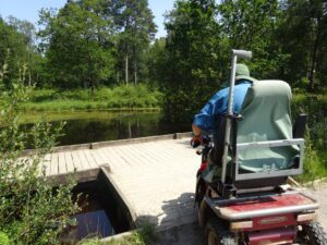
The the short sections of board walk, are easy to traverse.
]]>
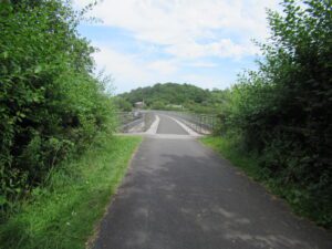
Location : Sourton
Starting Point : Pump and Pedal
OS Grid Reference : SX547917
Distance : 3.3 Miles
Route Surface : Asphalt, but pot holed in places on the road to the Dam
Category : Level One / Two
There is a very good easy access Disabled Toilet at the Pump & Pedal
This Ramble boarders on being a Level 2, because of the steep link path ( about 10 yards ) between the cycle path and the road. Along with the access road has some very bad Potholes. It is worth the effort, as there are some lovely views.
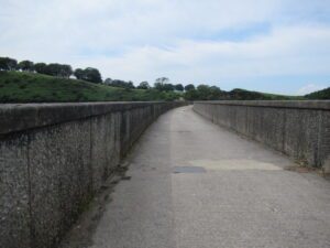
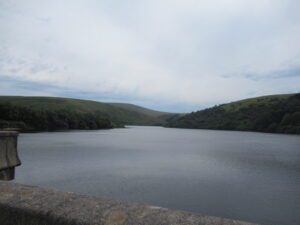
Both the Viaduct and the Dam, are accessible from Okehampton Station via the cycle path.
]]>
Location : Sourton
Starting Point : Pump & Pedal
OS Grid Reference : SX547917
Distance : 3.1 miles
Route Surface : Asphalt
Category : Level 1
There is a very good easy access Disabled Toilet at the Pump & Pedal
This ramble is worth doing, just for the views from the viaduct. Its an easy Level One ramble on Asphalt, with a bit of information about the Railway Line.
There is limited parking outside the cafe, but usually plenty of space to park on the road.
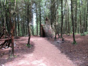
]]>Location : Haldon Forest
Starting Point : Haldon Forest Park
OS Grid Reference : SX881849
Distance : 1.7 Miles
Route Surface : Coarse Sand
Category : Level 1
A mobility scooter is available for hire at this site through the Countryside Mobility Scheme.
Setting off from the main car park at Haldon Forest Park, this is a relatively level route, with gentle undulations.
There is a disabled toilet, which is accessible by all types of scooter or chair
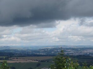
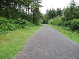
Although it is a short walk it offers excellent views to the east, north and west at various points on the route
The above photo shows the good quality of compacted coarse sand path of the route.
]]>Location : Haldon Forest
Starting Point : Obelisk car park
OS Grid Reference : SX921808
Distance : 1 mile
Route Surface : Gravel for mot of the route or coarse sand
Category : Level 1
No facilities
This route is a nice short circular walk with views of the obelisk, but the best bit is the view of Exmouth and the Exe Estuary. There are two options, short loop and long loop, but the long loop only adds a quarter of a mile so both are not very far, the long loop is listed separately.
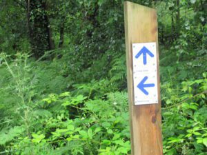
The route is well sign posted, as are all the official walking routes on the hills.
The first section of the walk to the viewpoint, can be messy after heavy rain, but not enough to affect the scooter/wheelchair.
]]>